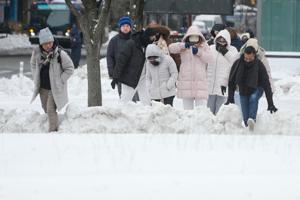
URGENT UPDATE: Residents in St. Louis are bracing for significant snowfall and freezing temperatures tonight as the National Weather Service (NWS) issues a critical forecast. Snow is expected to begin this evening, with a 50% chance of precipitation before 1 a.m., when temperatures will drop to around 15 degrees. Drivers should prepare for slippery roads and hazardous conditions.
As of this afternoon, St. Louis is experiencing increasing cloud cover with a high near 39 degrees. The NWS predicts a mix of rain and snow between 4 p.m. and 5 p.m., with a 30% chance of precipitation. Snow accumulation may lead to disruptions for evening commuters, emphasizing the need for caution on the roads.
Looking ahead, the weather is expected to stabilize after tonight. The latest Hazardous Weather Outlook indicates no significant weather threats from Thursday through Tuesday. Conditions will improve with clearer skies and a high of 24 degrees on Thursday, followed by cooler nights and a gradual temperature rise into the weekend.
Friday will see a high near 39 degrees, with mostly cloudy nights and partly sunny days expected to follow. However, residents should prepare for a 20% chance of rain on Sunday, as temperatures begin to rise slightly into the mid-40s by Tuesday.
Stay informed and prioritize safety as St. Louis navigates this winter weather. With conditions changing rapidly, residents are encouraged to monitor updates from the NWS and local authorities.