Strong Storms Return Tonight Across Southern US with More Rain Expected Friday
Strong to severe storms are impacting areas mainly along and south of the I-20 corridor tonight, driven by a slow-moving cold front and an upper-level disturbance. The latest updates from the CBS 42 Weather Livestream Channel confirm a marginal severe risk (Level 1/5) with primary threats of large hail and damaging winds. Many locations are already expected to receive between 2 and 3 inches of rain, offering a small but important respite from ongoing drought conditions.
Tonight’s storms remain a clear concern for residents in the southern US as the cold front drifts southward. This activity will mostly affect regions south of I-20, with intense rainfall and scattered severe thunderstorm activity anticipated. Lows will be in the lower to mid-50s, maintaining cool conditions overnight.
Thursday Brings Brief Break with Cooler Temps and Dry Weather
The storm system eases into the Gulf Coast by Thursday morning, allowing rain to taper off and skies to partially clear. Thursday promises a noticeable drop in storm activity, with highs in the mid-70s and partly cloudy skies providing some relief to the wet conditions.
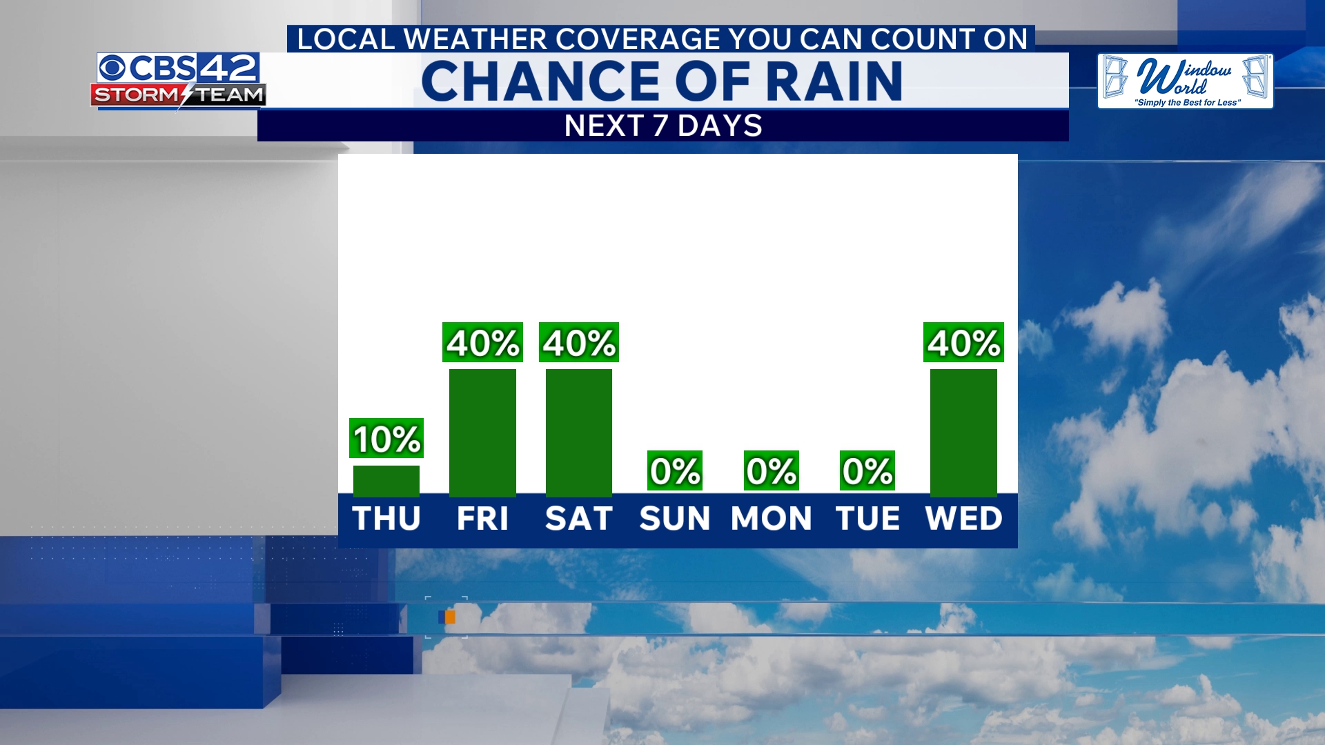
More Rain and Thunderstorms Target Friday and Weekend
Looking ahead, an area of low pressure tracking along a stalled coastal boundary will trigger renewed showers and thunderstorms on Friday. Though these storms won’t carry a severe risk, scattered showers and a few moderate thunderstorms are expected throughout the day. Temperatures will cool further, with highs in the upper 60s, signaling an unmistakable shift toward autumn-like weather.
Friday night into Saturday morning will see the heaviest round of rain and storms, driving down lows to the upper 40s and near 50 degrees. Showers may persist into Saturday morning but will gradually clear by the afternoon as highs hover in the upper 60s. Saturday night is projected to be mostly clear and colder with lows dropping into the 40s.
Sunday offers a clean weather break with dry conditions, plenty of sunshine, and highs remaining in the upper 60s. This brief window of calm will come after a vigorous few days marked by fluctuating temperatures and stormy conditions.
Why California and US Readers Should Watch This Storm Complex
While this storm system currently targets southern states along and south of I-20, its pattern underscores a broader trend of volatile weather this week across many US regions heading into the weekend. California residents should closely monitor local forecasts as similar upper-level disturbances could trigger showers or storms, particularly in northern and central parts of the state.
The combination of heavy rains and strong winds raises concern for flash flooding in drought-stressed areas as well as power outages from downed branches or hail damage. The marginal severe risk means damage is unlikely to be widespread but cannot be ruled out in storm hotspots.
Key Takeaways for Immediate Everyone
- Tonight: Marginal severe storms south of I-20 with hail and damaging winds possible
- Thursday: Dry day with cooler highs mid-70s and partly cloudy skies
- Friday: Scattered showers and thunderstorms return, highs upper 60s
- Friday night–Saturday morning: Heaviest rain and storms, lows dropping to upper 40s
- Weekend: Clearing Saturday afternoon, dry and sunny Sunday with highs near 70
“Tonight’s storms will help chip away at drought with 2 to 3 inches of rain falling in many areas,” said CBS 42 Weather Livestream officials.
Residents are advised to stay alert to changing weather conditions tonight and into the weekend, especially along areas prone to flooding or storm damage. Check local advisories and tune in to trusted weather livestreams for real-time updates.
The storm system remains dynamic and will continue to evolve as it moves eastward, impacting millions across the southern US and potentially influencing Pacific coast weather patterns as we head into the weekend.