URGENT UPDATE: Virginia has officially declared a state of emergency as a massive winter storm is set to impact the region this weekend. Residents are urged to avoid all travel as heavy snow and gale-force winds are forecast to hit Virginia and West Virginia.
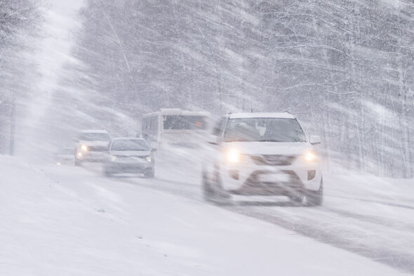
The National Weather Service (NWS) warns that a significant, long-duration winter storm will bring widespread heavy snow, sleet, and freezing rain from the Southern Rockies to New England through Monday, January 30, 2023. This storm is expected to result in widespread travel disruptions, prolonged power outages, and extensive tree damage.
Virginia is bracing for up to 12 inches of snow, while West Virginia could see between 9 to 12 inches of snow and ice accumulations of approximately 0.2 inches. As conditions deteriorate, the NWS warns of dangerously cold wind chills and near-record-breaking temperatures expected from Friday night through early next week.
Later on Sunday, freezing rain is anticipated to coat the Piedmont region with around a quarter-inch of ice, creating hazardous travel conditions as it will glaze over any snow or sleet that has already fallen. The NWS cautions that travel could become treacherous, particularly as the storm intensifies.
In response to the impending storm, Governor Abigail Spanberger has declared a state of emergency, emphasizing the potential for hazardous cold temperatures to prolong the storm’s impacts and hinder road clearance efforts. “Please, please listen to the requests that we are putting out. Please stay off the roads, particularly beginning Saturday night, all day Sunday, and into Monday,” she urged during a press conference.
State officials confirm that the combination of snow, sleet, freezing rain, and extremely low temperatures may significantly elongate the time required to clear roads across the Commonwealth. Virginia residents are advised to heed local warnings and prepare for severe weather conditions.
As the storm approaches, the NWS continues to monitor the situation closely, providing updates on the evolving conditions. Stay tuned for further developments as this urgent weather event unfolds.