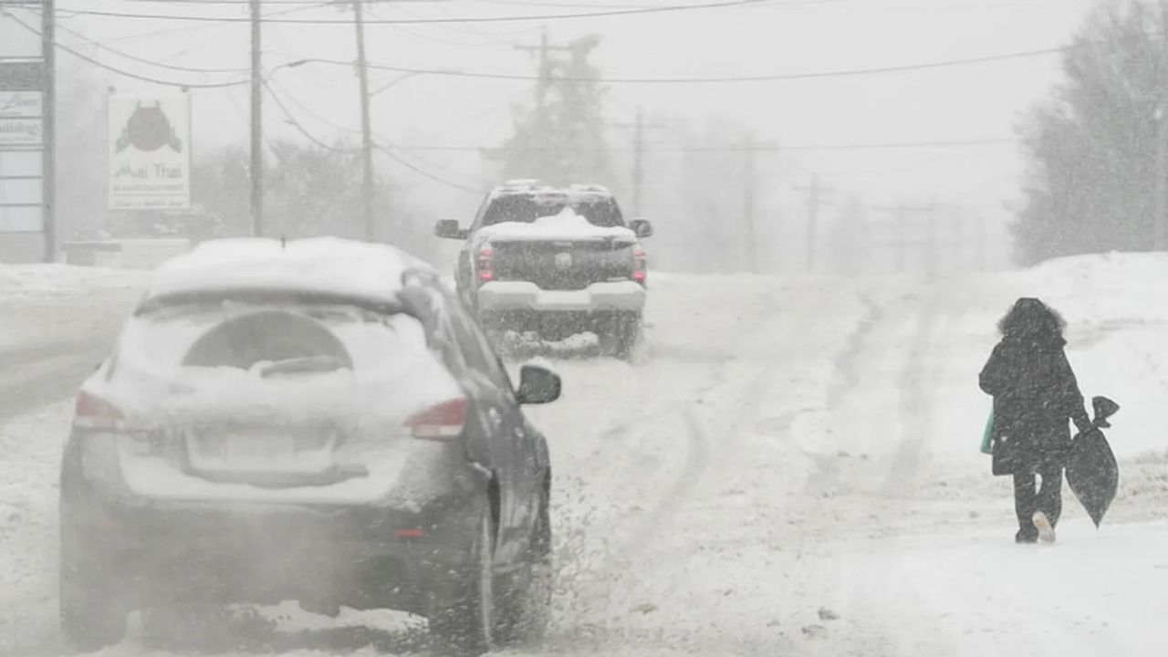
URGENT UPDATE: A powerful winter storm is currently wreaking havoc across New York City and the Tri-State area, delivering heavy snow and life-threatening cold as of February 22, 2026. Blizzard warnings are in effect, forecasting up to 17 inches of snow in NYC, with surrounding regions potentially facing up to two feet, marking this as one of the most severe winter storms in recent years.
The National Weather Service warns of heavy, wet snow accumulating at rates of 2 inches per hour, transitioning to sleet and ice in coastal regions like Long Island and along the I-95 corridor. Winds are expected to gust between 35-70 mph, creating near-blizzard conditions with low visibility and whiteouts anticipated through Monday. Temperatures have plummeted below freezing, with “feels-like” conditions dropping below 0°F due to an influx of Arctic air, colder than any period experienced in NYC over the past eight years.
Blizzard warnings cover key areas including NYC, New Jersey, Connecticut, parts of Pennsylvania, the Hudson Valley, and southern New England. The NOAA’s Winter Storm Severity Index indicates substantial to extreme impacts. The heaviest accumulations—over 12 inches—are forecast east and southeast of I-95, stretching from Philadelphia through NYC to Boston. Coastal zones are at increased risk for sleet and ice, which may lead to power outages.
Here’s a breakdown of expected snowfall and key risks:
- NYC Core: 6-17 inches, with significant whiteouts and heavy snow rates
- Long Island / Coastal NJ: 6-12 inches with sleet mix, leading to icy roads and potential outages
- Hudson Valley / Inland CT: 12-24 inches, blizzard conditions, and snow drifts
- Philadelphia to Boston: 12+ inches, with extreme impacts and flooding risks
As the storm intensifies, significant disruptions are already visible. DoorDash has suspended operations in NYC until at least Monday at 10 a.m. due to hazardous conditions. NYC’s Code Blue is in effect, ensuring shelters remain open for the homeless amid this severe cold snap. Schools, medical facilities, and major transit services—including subways and flights—are facing widespread closures and delays. The city’s sanitation department has deployed 2,300 plows in response to accumulating snow, but travel is nearly impossible during peak hours on Sunday.
Tragically, at least five New Yorkers have been found deceased outdoors prior to the peak of the snowfall, highlighting the severe vulnerabilities posed by extreme cold. This storm evokes memories of the devastating 1888 Great Blizzard, which claimed nearly 400 lives and set records for snow drifts. Current conditions threaten to strain infrastructure and create prolonged sub-zero temperatures into next week. Reports of rising power outages are emerging, with emergency states declared in New Jersey.
Residents are urged to avoid travel, stock essential supplies, and stay alert to local alerts. NYC Emergency Management emphasizes precautions against hypothermia as plowing prioritizes major roadways, leaving side streets potentially treacherous.
As this high-impact storm unfolds, vigilance is crucial through Monday, with snow tapering but cold conditions lingering. This event could rival historic storms in terms of disruption. Stay informed through official channels to minimize risks and ensure safety during this extreme weather event.