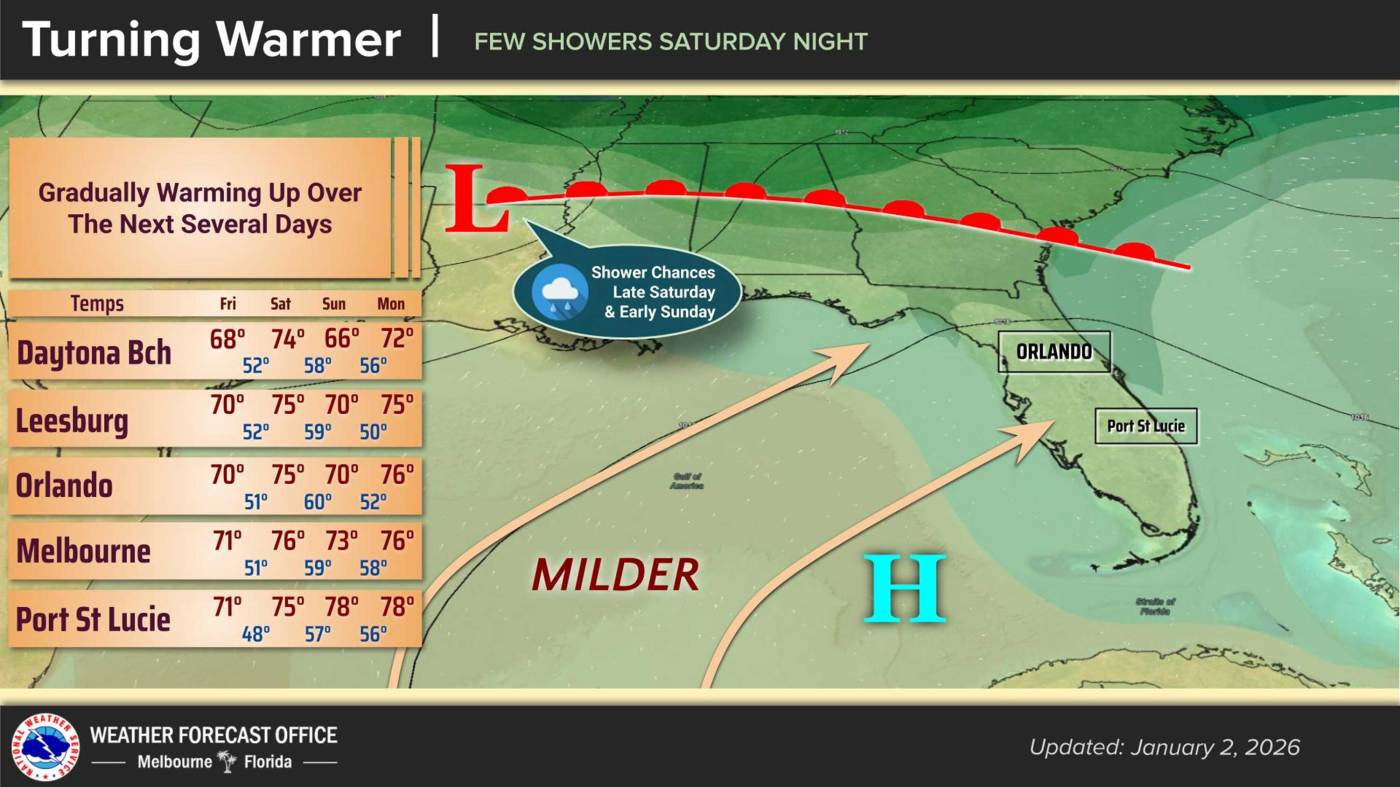
UPDATE: Central Florida is experiencing a warming trend today, with temperatures soaring to around 70°F as residents prepare for a significant shift this weekend. The National Weather Service in Melbourne confirms that overnight lows will rise to the upper 40s, creating a mild atmosphere before a cold front moves through the region.
As of Friday, January 5, the pleasant weather is expected to hold through Saturday, but a cold front sweeping across the Southeast U.S. will bring a noticeable drop in temperatures. High pressure is currently dominating the area, resulting in dry conditions and light westerly winds. However, cloud cover will thicken overnight, setting the stage for the impending front.
On Saturday, temperatures are predicted to reach the mid 70s, but conditions will shift dramatically as the cold front approaches. The NWS warns that southwesterly winds could gust up to 20 mph in some areas, and moisture levels will rise throughout the day. Most of Saturday will remain dry, but scattered showers are anticipated late Saturday into Sunday.
Sunday’s forecast shows a slight cool down, with temperatures expected to hover in the 70s for most of Central Florida. However, areas north of Interstate 4 could experience a dip into the upper 60s, with overnight lows settling in the 50s.
Looking ahead, the start of next week will bring even warmer conditions as temperatures are expected to climb to the upper 70s to lower 80s by Thursday. Coastal regions may see overnight lows in the lower 60s.
Residents are urged to stay tuned for updates as the weather changes this weekend, and prepare for the possibility of rain as the cold front moves through. This weekend’s weather shift marks a pivotal moment for Central Florida, making it essential for everyone to stay informed and plan accordingly.